Star Swamp Bushland Reserve

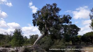
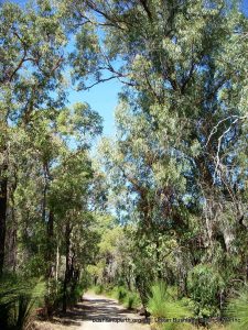
Marri - Tuart Forest.

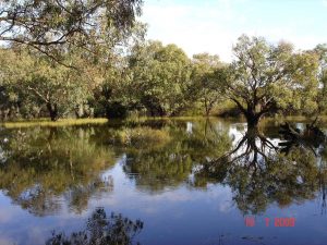
Star Swamp Bushland is a 96 hectare Class-A reserve, vested in, and managed by the City of Stirling. It is located 15 km north of Perth and comprises four hectares of semi-permanent freshwater lake with paperbark trees and 92 hectares of banksia, Tuart, Jarrah and Marri woodlands, and areas of low heath.

The Reserve is a declared Bush Forever site [no. 204] that has been set aside for the purposes of conservation, passive recreation and education.  It is a remnant of the once extensive chain of wetland lakes and swamps which filled low-lying areas between ancient sand dunes.

Start your enjoyment of Star Swamp from the parking area at Groat St, North Beach.  The Reserve has many walking trails including the 1.4 km  Star Swamp Heritage Trail.  It also houses the Henderson Environmental Centre which gives the whole community a focal point for activities within the Reserve.

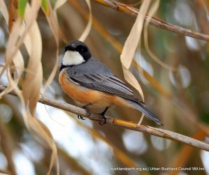
Star Swamp provides a breeding site and sanctuary for both waterbirds and other bushland bird species with over 80 species of birds having been recorded. The bushland is also an important habitat for species of reptiles, insects, and spiders.

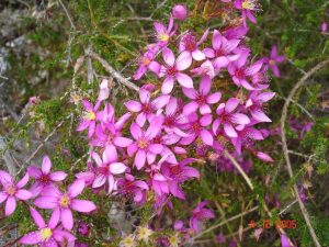
The main flowering period is between August and October, although there are plants in flower all year round. Over a dozen species of orchids occur in the bushland and several hundred flora species have been listed.

Videos

View the Friends’ YouTube videos  for more insights into this remarkable place. The videos have been produced by Grey Eyed Films and feature David Pyke demonstrating and speaking about various features of Star Swamp.

History
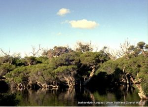
Star Swamp of the 80s.

From the mid 19th Century, the area that became known as the Star Swamp Bushland Reserve was part of a dairy and cattle lease held by J H Okely of Wanneroo. The origins of the naming of the swamp are unclear.

The area was used as a camping area and watering place for drovers using the Coastal Stock Route.  In the early 1900s, the area west of Star Swamp was sub-divided for housing development, gradually expanding to be a popular seaside holiday destination.During the Second World War, a squadron from the Australian Army 10th Light Horse Division was stationed nearby on coastal watch duties, and used the swamp to water their horses.

In the 1970s, local residents waged a strong campaign of community action to prevent Star Swamp from being developed for housing.  This eight year campaign was supported by local politicians, academics and environmentalists and resulted in the gazettal, in 1985, of the Star Swamp Bushland as an A-Class Reserve.

Sources of Information

The material presented here is sourced from the Star Swamp management plan and from the Friends of Star Swamp.

Bush Forever Site Map  Download.  Bush Forever Description  Download.   Bush Forever Species List Download.

All Gallery images  have been contributed by David Pike who retains absolute copyright.

Ridges and Adjacent Bushland – Nowgerup and Yanchep

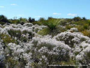
Common Smokebush.

These two contigous Bush Forever sites 288 and 381, being Yanchep National Park and Adjacent Bushland (not to be confused with that part of Yanchep NP which lies west of Wanneroo Road) and Ridges and Adjacent Bushland, Yanchep/Nowgerup, form, by urban bushland standards, a very large tract of land comprising over 5700 ha.

Site 381 is rated at greater than 90% as being in pristine/excellent condition with the remainder rated as ‘very good’. Site 288 is rated as greater than 90% as very good to excellent. These are outstanding ratings for such a large site on Perth’s doorstep!

Additions to Yanchep National Park

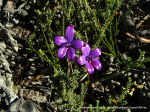
Purple Enamel Orchid.

There have been long-standing recommendations for part of State Forest 65 (BF Site 288 – Ridges) to be added to Yanchep National Park. From the Management Plan – Parks and Reserves of Yanchep and Neerabup: “The Ridges area contains significant conservation values including:


• species and communities restricted to limestone ridges (including threatened species and
communities);
• species and communities that are not represented or not well represented within the conservation
reserve system;
• occurrence of jarrah near the northern limits of its range (a small area of jarrah woodland occurs in
Yanchep National Park);
• important ecological value; 
• a seasonal wetland.
Mining leases M70/140 and M70/142 occur within the Ridges area and have been excluded from the proposed addition to Yanchep National Park at this stage. However, because the lease areas contain some of the best remaining examples of threatened limestone vegetation, it is recommended that they should be included in the national park if mining does not proceed. Other mining and petroleum tenements also apply to the Ridges area“.

Physical Environment and Vegetation

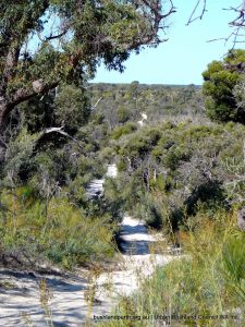
Bailey Road.

The Swan Coastal Plain consists of a series of coastal dunes, running roughly parallel to the coastline. The Spearwood Dune System is bound to the east by the Bassendean Dune System and to the west by the Quindalup Dune System. Each system has a distinctive geology, vegetation, topography, drainage pattern and soil characteristics.

Yanchep – Ridges and Adjacent Bushland is situated across the Quindalup, Spearwood and Bassendean Dune Systems, and holds a number of wetland/dampland systems. In the Spearwood Dune System, leaching has occurred causing the carbonate to precipitate below to form hard compact limestone with prominent Tamala Limestone outcropping prominently in places.


This variety of landforms gives rise to many vegetation complexes, being particularly rich in heathland species, and varieties of tree forms including Banksia species and various eucalypts including Jarrah (Euc. marginata), Marri (Euc. calophylla) and Pricklybark (Euc. todtiana); also Moonah (Melaleuca preisii) on damper soils, giving rise to very high visual landscape values.

Access and Recreational Opportunities

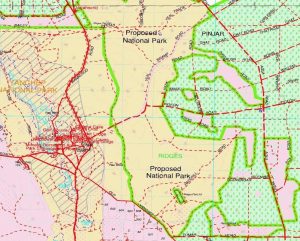
15CALM1-50kMap.

This large site is off limits to vehicles unfortunately. However walkers are welcome. Suggestion; start at the junction of Wanneroo and Bailey roads and proceed along Obidos Road; the latter being especially a delight in wildflower season. (see map – second image in Gallery).

The site is also traversed by part of the long distance Coastal Plain Walk Trail as described on the ‘trails’ page of the Park’s website – please take note of the need for suitable provisioning if attempting longer sections of this walk.


The area will repay a visit at any time but spring shows the fantastic diversity of wildflowers at its stunning best.

Source of Information

Bush Forever site descriptions:  BF Site 288 and  BF Site 381.

Management Plan – Parks and Reserves of Yanchep and Neerabup 2012.

Mosman Park and Minim Cove Bushland

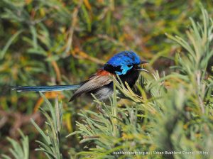
Variegated Fairy-wren families.

The South Mosman Park Bushland is located within the Town of Mosman Park and is situated adjacent to the Swan River. It is a part of the Bush Forever Site 335 (Chidley Point and Adjacent Bushland) and Bush Forever Site 335 (Minim Cove) and is recognised as containing the only population on the mainland in the Perth Region of the species Boronia alata – Winged Boronia. 

It also has a National Trust of Australia (WA) classification due to the presence of exposed Marine Shell Beds containing fossil fauna and is one of the very limited numbers of bushland areas on the Swan Estuary that has particular conservation value in providing habitat for fauna and linkage between areas of bushland.


Much of the adjacent area is used for recreation with the bushland surrounded by landscaped parklands.The foreshore is formed by cliff and as such affords little access to the general public. Informal tracks have been made to the water level, however they are eroding the site.

Landscape Values

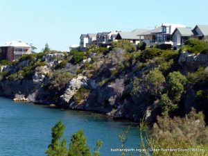
Cliff bushland at Minim Cove.

The landscape of the area is made up of Tamala limestone commonly known as Coastal Limestone and dates back to the Pleistocene Age The rock is composed of a cemented dune sand (aeolianite) consisting of shell fragments of marine origin and quartz grains in calcium carbonate.

The Swan Coastal Plain is made up of three dune systems. The Bassendean Dune System, containing low hills and leached infertile soils. This system is the most easterly and the oldest for the three systems.


West of this is the Spearwood Dune System which is younger with higher hills and less leached soils. Even further west is the youngest of the dune systems and known as the Quindalup Dune System. This system is composed of calcareous dune sands forming along the coastline.

The study area is found within the Spearwood Dune System. Topographically this system is more variable and undulating and as such contains greater relief. The hills are higher and the soils are younger. It is within this system that the coastal limestone has been formed by a process of leaching and deposition of surface soil carbonate.

The soils of the Mosman Park area are derived from the weathering of the limestone rock, giving rise to a soil profile which consists of shallow yellow and brown sands overlying limestone. There are deeper soils that occur in the valleys or swale areas while the shallow soils are associated with the more exposed and elevated limestone hilltops.

Three pre-European broad complex types are associated with the area

Limestone Heathland

The shallow soils over limestone, exposed windy environments and limited nutrients give rise to typical limestone heath communities. These are associated with the limestone hills, ridges and parts of the cliff face forming the river foreshore. Generally the heath communities are low and have a diverse flora composition. Many species are represented including Acacia cuneata, Acacia rostellifera, Acacia xanthina, Grevillea thelemanniana, Melaleuca huegelii, Melaleuca systena, Spyridium globulosum, Templetonia retusa and Xanthorrhoea preissii.

Tuart Woodland

On the deeper soils under more sheltered conditions woodlands to open forests of Tuarts (Eucalyptus gomphocephala) as the dominant species along with Jarrah, Marri and in some cases Limestone Marlock (Eucalyptus decipiens). This community also supports a middle stratum containing such species as Banksia, peppermints (Agonis flexuosa), Christmas tree (Nuytsia floribunda) and Sheoak (Allocasuarina fraseriana). Shrubs such as Jacksonia sternbergiana, Hakea prostrata,
Banksia sessilis and Acacia cyclops were also found. A diverse lower storey is also associated with this community.

Low Closed-Forest

This community was found on the cliffs and dominated by Rottnest Island Pine (Callitris preissii). Out of all the communities this one no longer exists in its true form due to repeated fire and clearing. Other species found in this community include the, Acacia xanthina, Agonis flexuosa, Eremophila glabra, Phyllanthus calycinus and Spyridium globulosum.

Recreation and Heritage

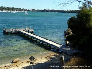
View to the jetty.

Recreational opportunities abound at and around Mosman Park Bushland. Choose from: easy walking in a bush environment, family picnicing, cycling along the dual use path, pumping the legs in a truly scenic setting, nature observation, …it’s all there.

The site has important passive recreational values for the local and more regional population of the area. The dual use path is a Regional Recreation Path which is part of the Perth Bicycle Network and provides a link along the river for both cyclist and walkers.


The area is regularly used by local for walking, exercising and social interaction. The foreshore is also used for recreational fishing and canoeing. Birding can also be rewarding.

The cultural values include the cliffs which expose a rich fossiliferous shell bed that was deposited towards the latter part of the Pleistocene Era. The bed is reported to be one of the best preserved and most informative deposits of its age in  Western Australia. The cliffs are listed by the National Trusts of WA and are regularly used for teaching purposes.

The site also adjoins the heritage listed Aboriginal camp site at Minim Cove. This site has been ascertained to be over 10,000 years old through carbon dating of Aboriginal artefacts found at the site.

Resources

Town of Mosman Park – South Mosman Park Bushland Management Plan.

Bush Forever Site 334 – Description – Chidley Point and Adjacent Bushland.

Bush Forever Site 335 – Description – Minim Cove, Msman Park. (two pages).

Bird checklist for Minim Cove.

The Friends of Mosman Park Bushland look after this place.

Lightning Swamp Bushland

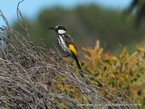
White-cheeked Honeyeater.

Lightning Swamp is one of a number of major reserves located on the Bassendean Dune system north of Perth. It is 70 hectares in size; an A class reserve, located 11 km NE of Perth between Malaga Drive and Reid Highway in Noranda with best access via Matthews Close.

It contains a range of mixed bushland communities and is representative of the natural environment that once covered the Swan Coastal Plain before urban development cleared  vast tracts of Perth’s bushland. 


LSB holds a diverse mixture of plant communities occur from winter-wet swamplands of Eucalyptus rudis and Melaleuca communities, areas of Corymbia calophylla forest, to upland sites containing Banksia ilicifolia and B.menziesii woodlands.

More than 180 flora species have been identified including two priority flora (Macarthuria apetala, Jacksonia sericea) and a declared rare flora (Caladenia huegelii).

The bushland provides habitat to over 125 native fauna and avian species. A number of regional migratory birds, including the threatened Carnaby’s Cockatoo, visit this bushland corridor due to its healthy and diverse vegetation.

Lightning Swamp comprises a seasonal wetland, damplands and a perched wetland which support a higher diversity of aquatic and fringing vegetation in comparison to permanent wetlands. The site provides habitat to at least seven endemic frog species within the wetlands and riparian zones.

The Wetlands

Eastern wetland

Lightning Swamp has several main water bodies  lying across the site. These dry over summer.  See map.

The perched wetland in the north east is in good condition. It tends to be damp all year round due to its peaty clay base with poor hydraulic conductivity.  Perched wetlands such as this (i.e. wetlands not connected to the ground water) are relatively rare on the Swan Coastal Plain.


The western wetland is shallow and its gradual slope has lead to the growth of fringing vegetation. The Wonga Road Main Drain traverses the site west to east.

Plant Communities

Lightning Swamp contains six distinct plant communities, giving the reserve a richly varied structure.  See map.

Zone 1: Flooded Gum Seasonal Wetlands.

The eastern seasonal wetland dominates this zone.

Flooded Gum  (Eucalyptus rudis) and Moonah (Melaleuca preissiana) are the dominant tree species with the Christmas Tree (Nuytsia floribunda) also occurring in the region.

Woollybush (Adenanthos cygnorum),  Regelia ciliata and Balga – (Xanthorrhoea preissii) dominate the shrub layer.

Pink Summer Starflower.

Zone 2: Banksia Woodlands

This area is typical of many Banksia woodlands of the Bassendean sands.  It contains declared rare flora.

The key trees are Firewood Banksia (Banksia menziesii), Candlestick Banksia (Battenuata), Hollyleaf Banksia (B ilicifolia), Christmas tree (Nuytsia floribunda) and Prickly Bark (Eucalyptus todtiana).


Zone 3: Perched Wetland

The perched wetland in the north-east corner is surrounded by banksia woodland.

This zone is in good condition. Species such as Baumea articulata and Baumea arthrophylla dominate with Moonah (Melaleuca preissiana) forming part of the littoral community.

Zone 4: Banksia Ridge

This is a transition zone between the banksia woodlands and the two seasonal wetlands.  Its dominant flora are Marri (Corymbia calophylla),  Moonah (M. preissiana) and the Common Sheoak (Allocasuarina fraseriana).

Zone 5: Moonah – Hollyleaf Banksia Seasonal Wetland

The wetland in this zone is in excellent condition. Terrestrial plants include Moonah (M. preissiana), Marri (C. calophylla), Hollyleaf Banksia (B. littoralis), and shrubs of Hibbertia sp, Balga (Xanthorrhoea preissii), Purple Flags (Patersonia occidentalis), Woolly bushes (Adenathos sp.) and Fan Flower (Scaevola repens).


Zone 6: Moonah Transitional Wetland

This area is similar to zones 1 and 4. It is generally dominated by Moonah, Marri, Hollyleaf Banksia and Nuytsia floribunda. The water tolerant species (M. preissiana, B. littoralis) are interspersed with woodland species. A shrub layer of White Myrtle (Hypocalymma angustifolium), Balga and Purple Flags form a mixed understorey.

Birdlife at Lightning Swamp

Rufous Whistler.

The Lighning Swamp wetlands attract a large number of waterbirds, whilst the banksia woodland, heathland and riparian fringe of the wetlands provides an ideal habitat for a large complement of bush birds.  Endangered Black Cockatoos are often sighted feeding and roosting in banksias and Flooded Gums.

The ephemeral swamps, with their inundated thickets, act as important roosting and nesting sites for waterbirds such as the Eurasian Coot, Purple Swamphen and Australian Wood Duck during winter. See the eBird list for this location.

Resources

Lightning Swamp Bushland is a Bush Forever site.

Bush Forever Site Map Download.    Bush Forever Description  Download.  Bush Forever Species List  Download.

Source of Information

Material presented here has been adapted from Lightning Swamp Bushland  Management Plan prepared by The City of Bayswater and the Friends of Lightning Swamp.

Lake Claremont

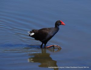
Purple Swamphen.

Lake Claremont is a delight to visit, particularly between August and January when birdlife is abundant.

Once badly degraded, through the highly successful partnership between the Friends of Lake Claremont and the Town of Claremont, the Lake is now a shining example of the benefits of a major environmental rehabilitation program.
Lake Claremont is a Conservation Category Wetland and a Bush Forever Site.

Lake Claremont’s Birds

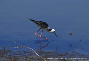
White-headed Stilt are common.There are over 100 species of birds recorded at Lake Claremont. A tremendous record has been maintained with bird censuses being carried out since 1993. Three of the most common waterbirds include the Pacific Black Duck, Grey Teal and Eurasian Coot and one of the rarest – the Freckled Duck.  Birds in and Around Claremont.

The richest period for bird observation is November to January, this being due to several factors including the presence of breeding pairs and young and the change in habitat structure brought about due to the natural decline in lake water levels.

The species’ diversity and abundance are generally at their highest in January when the lake is nearly dry. The most valuable habitats for birds in the area are those that provide adequate shelter for breeding. The shallows and mudflats are valued by birds including the five species of local wading birds recorded at Lake Claremont.

Local Geology

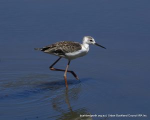
Juvenile White-headed Stilt.Lake Claremont lies in a depression in the Spearwood System of coastal sand dunes. It is a true swamp in that it lies above but separate from Perth’s underground aquifer. This subsoil water flows continuously towards the river and ocean in a north east to south west direction. Several swales have been made in order to improve water quality.
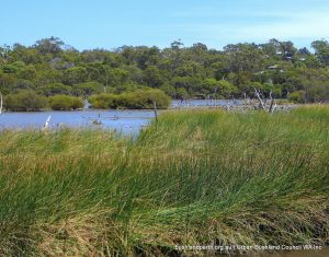
The swamp lies in a valley between coastal dunes where, on the west side of the swamp, the ground rises rapidly from 1.5 metres to 12 metres. Immediately prior to 1950, the swamp at high water mark enclosed an area of approximately 20 hectares. During the 1950s and 1960s areas were reclaimed and this reduced the area of the open water to approximately 15.7 hectares at high water mark.

The soil of the coastal plain near Claremont is a fine graded silica and calcium carbonate sand. Water action on the carbonate has in places cemented the sand into sandstone mass calcific sheets and pinnacles. In the actual vicinity of the swamp there is a thin deposit of marl, consisting of detrital material settling out of solution from swamp waters.

Hydrology

Lake Claremont View

Lake Claremont is located within a reserve which covers an area of 70ha, with approximately 16ha of open water. The catchment area of Lake Claremont is dominated by residential areas and large recreational facilities, including several sports fields, a public golf course and a public swimming pool. The water quality of Lake Claremont is strongly affected by the activities occurring throughout its catchment area.

The Lake is a surface expression of the superficial aquifer, with groundwater entering the Lake on the north-eastern side, flowing through the Lake and exiting on the south-western side.

The quality and quantity of the groundwater will therefore have a significant effect on the quality and quantity of the surface water within the Lake.

Vegetation

The pre-European vegetation of Lake Claremont is Karakatta Complex – Central and South, however the majority has been cleared through recreation and residential development. The original vegetation at Lake Claremont would have consisted of a central swamp zone of Paperbarks (Melaleuca rhaphiophylla), with Tuarts (Eucalyptus gomphocephala) and Grass Trees (Xanthorrhoea preissii) surrounding small water holes. The Bush Forever Report 2000 classified the vegetation surrounding the wetland as a Melaleuca rhaphiophylla Low Closed Forest.

Access

Lake Claremont can be accessed from many points via the local roads network. There is a dual use path surrounding the east and northern shores and pedestrian pathways circumnavigate the entire Lake.

Source of Information

Lake Claremont Management Plan 2010.

Town of Claremont – Lake Claremont Page. 

The Friends of Lake Claremont have driven the restoration of Lake Claremont, gaining in the order of $600,000 in federal and state government grants.

Donations

Donations and support from the wider community help us to protect and campaign for our Urban Bushland.

Make a donation

newsletter Signup

Get the latest news and key events delivered to your inbox.

Become a Member

We are a peak environmental group in WA. One of our key strengths is our amazing group and individual members.

Become member
Location

Urban Bushland Council WA Inc

2 Delhi Street, West Perth, WA, 6005

(08) 9420 7207 (please leave a message)